Page 1 of 1
Cape wrath, Loch dionard question
Posted: Sat Apr 02, 2022 6:43 pm
by fatbikerbill
Hi all,
I have a route planned from oykel Bridge doing the northern loop of the ht550 and a wee diversion up to cape wrath.
https://www.google.com/maps/d/u/0/edit? ... 999998&z=9
Hopefully you can see that.
So we were wondering, could we return from Cape Wrath via the Loch Dionard Valley? Or is it a bog fest and not worth it?
Thx
Re: Cape wrath, Loch dionard question
Posted: Sat Apr 02, 2022 7:12 pm
by fatbikephil
fatbikerbill wrote: ↑Sat Apr 02, 2022 6:43 pm
Hi all,
I have a route planned from oykel Bridge doing the northern loop of the ht550 and a wee diversion up to cape wrath.
https://www.google.com/maps/d/u/0/edit? ... 999998&z=9
Hopefully you can see that.
So we were wondering, could we return from Cape Wrath via the Loch Dionard Valley? Or is it a bog fest and not worth it?
Thx
This has been discussed before but nor sure when. I've not done it but know somebody who has - I think he went round the west side of the loch and it was "OK" but a bit hard going. The river crossing at the south end was doable but at the north end you'd have to fight your way a long way downstream to cross without swimming..... The track from Loch Dionard to the HT route is good but affy steep.
An alternative would be to follow the double track past Gobernuisgach lodge, head up the Hope road and then do the Cashel dhu ford (which is OK other than in wet weather) and the track to the southern end of Loch Eriboll.
Re: Cape wrath, Loch dionard question
Posted: Sat Apr 02, 2022 7:36 pm
by woodsmith
It was me. See this thread.
viewtopic.php?f=10&t=17570&p=232034&hil ... rd#p232034
It'd be quite a push from the loch uo to the top but probably no worse than the bit of pushing coming up Glen Golly the other way.
Re: Cape wrath, Loch dionard question
Posted: Sat Apr 02, 2022 10:42 pm
by fatbikerbill
Cheers woodsmith.
Do you have a gpx of your route please.
I am guessing you went from lochan sgeireach, North West ish. It certainly looks like a hefty push (adventure) heading south eastwards in the opposite direction
I guess if its been dry then it could be a yeah, if it's wet then vote no.
Re: Cape wrath, Loch dionard question
Posted: Sun Apr 03, 2022 10:43 am
by woodsmith
fatbikerbill wrote: ↑Sat Apr 02, 2022 10:42 pm
Cheers woodsmith.
Do you have a gpx of your route please.
I am guessing you went from lochan sgeireach, North West ish. It certainly looks like a hefty push (adventure) heading south eastwards in the opposite direction
I guess if its been dry then it could be a yeah, if it's wet then vote no.
I don't have a GPX track of the actual route I took but this is the route I'd planned for that part of the trip. Between some shocking weather and a bout of Giardia not all of it got done . I didn't bike out to Cape Wrath as that's when I was ill and I'd previously hiked their at the completion of the Cape Wrath Trail. As you can see I'd originally planned to go around the southern/western shore of Loch Dionard but when i got there it looked like a lot rougher proposition. The northern/eastern side was a fairly easy push ( I was on 3" tyres) and might even be partly rideable on a fat bike.
https://ridewithgps.com/routes/33218443
Re: Cape wrath, Loch dionard question
Posted: Sun Apr 03, 2022 11:35 am
by woodsmith
Duplicate post
Re: Cape wrath, Loch dionard question
Posted: Sun Apr 03, 2022 11:51 am
by whitestone
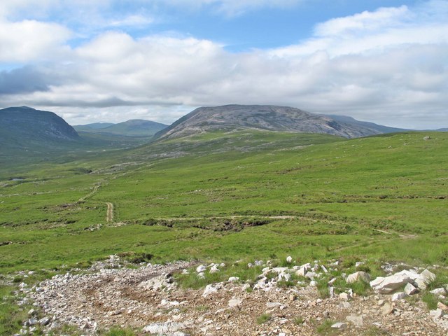
Choosing the satellite view for your route and zooming right in - there's no discernible path on either side of the loch so you are going to have a km or a bit more of pushing whatever. There's a quad bike track that follows the Allt an Easain Ghil for about half it's length down from Bealach Horn but you'd have another km or so of HaB to reach it.
There's a couple of shots of the track between Lochs Dionard and Sgeireach on Geograph, looks OK for the most part, probably no worse than the other part of it coming up from Glen Golly
The old stalker's path from Lochan Sgeireach to the outflow of An Dubh Loch is great fun, one of those true "out there" paths. This path hasn't been maintained for many years so there are the occasional "holes"

on the last descent to the burn it gets harder and harder to follow the route through the peat hags. (Oh, yeah - go to the right of the big boulder

) The initial push up from the burn is ridiculously steep, but once you get to the sharp corner (incidentally the furthest point north on the HT550) then it's pretty much rideable.
I did post some shots here but they are also on a blog post I did about the Northern Loop
http://bobwightman.blogspot.com/2017/05 ... hland.html
Re: Cape wrath, Loch dionard question
Posted: Fri May 06, 2022 9:24 pm
by fatbikerbill
so we did it. Cape Wrath & Loch Dionard, went on the south side in the end.
Details here -
viewtopic.php?f=10&t=21834&p=287833&hilit=wrath#p287833
Re: Cape wrath, Loch dionard question
Posted: Fri May 06, 2022 9:36 pm
by woodsmith
Excellent info thanks Phil. I shall try your way the next time I'm up there, later this summer hopefully.