So... Plan A was a train to Dundee last Saturday, then follow the 'Pictish Trail' north for a bit, divert off to bag some other routes, then use it to head south morphing into a route that would take me home. I'd got a ticket for £6.30 but a rail strike canned that plan and no bikes spaces were available on any other service that day. Cue plan B - drive to Blair atholl, blah, blah, blah. Then I saw the weather forecast - sun, sun and sun for 6 days straight. Once again I ventured onto the Scotrail site and low and behold, I could get me and bike onto a train to Stonehaven on the sunday afternoon - let's go with plan C! This would lead me into a variation of a tour I've done twice before, plus some of the Pictish trail and the usual make it up as I go along, 'cos I know all the trails style of cycle touring.
The train was an ancient intercity 125 with only 4 carriages. I now know far too much about Scotrail and it's issues with rolling stock but this seemed a step too far. Worse, the roomy guards van was sealed shut so I had to wedge the Jones into a narrow cubicle after first ousting it's occupants. Yes the train was rammed but I had a seat booked so the journey was fine, with many sea views on the way north.
Finally, 3pm saw me pedaling into a stiff, but cooling breeze, fetteresso forest and the Mounth my destination. Much shady fire road followed with much view looking and puzzlement at the complete lack of other people. Maybe they were all lazing around on the beach...
And speaking of lazing around, I arrived at Charr bothy at 5.30 and ended up staying there, it being empty, and me making a concerted effort not to bash through a planned route in one day...

It's a cracker and being sans fire, not used much for overnighters, despite being only a few k from the road. I had a good wander around checking out the views and generally relaxing, this being me on holiday.

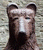
And came across this fella
I was up quite sharp and off up the next humongous climb, before the heat of the day hit. This would be a common theme as the days progressed.

Mount Battock (778m) There are many 'Mounts' around here - by one of those quirks of dialect it's origin is 'Mounth' a pictish word for hill, which then fell into normal vocabulary as 'mount' independent of the word 'mountain' A bloke on an e-bike suddenly appeared having ridden the whole climb, which I, of course, had pushed... But a fun descent followed and then straight into the fungle mounth. Mounth roads abound here - lit. 'Hill Roads' used by livestock holders to drive cattle from the hill farms to markets in the lowlands. For the peddler of bikes they provide a fine series of routes with a range of challenges....
After another hot climb one of my weeks many fine descents followed on a mix of made singletrack, more climbing and then a lovely natural rooty, rocky, rutted single track descent to Aboyne and a very sunny Deeside. At roughly halfway I met a chap coming the other way doing the whole Pictish Trail. Dan was from Dalgety Bay (everyone I meet in the hills comes from Fife) and gave favourable reports of the route. Aboyne provided food and gallons of various drinks (non - alcoholic, that's how hot it was!) whilst flaked out on the grass. I spent some considerable amount of time fighting with the OS app on the phone to plan my next riding. The OS app is sh*t. There I've said it. But it continually crashes, freezes and fails to download maps unless you have a 5 bar signal or wifi... So out with the Dakota and route planning done on a 2x1" screen!
I could bash over the next climb but I was less than motivated to do this given my pre trip aim of not doing just that. But if I did I could hit the Moray coast, follow the coast route and then get to my mates place via the fab river Findhorn path. But it all seemed a bit much so after further procrastination I went with an extra Deeside loop to Ballater and then back to Tarland. This was an all round Good Thing as after a monster climb Out of Glen Tanar I was subjected to some lovely trails - a fun descent back to Deeside, some easy road riding, buying cheap whisky in Ballater and then an absolute stoater of a trail through Cambus of May woods and Loch Kennord. Tarland is now trail centre central but on this occasion I avoided any 'sending' and just cruised down a track to the pub, which provided beer and food, obviously. Then onto a new trail (gasp!) an old road to Strathdon. Of particular interest, given dark O'clock was fast approaching, was the 'Lazy Well' which promised either a fine moorland bivvy, or a shed.

The shed had no roof so we went with the bivvy. This was hardcore extreme ultra (tm) as I was running a gauntlet with a range of biting terrors. The wildfowl ponds revealed a swarm of mozzies so I moved to a spot away from them, accepting death by midges. Sure enough they appeared in force as I pulled stuff from bags. I ran away to don a headnet and much smidge and set too, teeth gritted. But a very odd (if not un-precedented) thing occured - they all buggered off. No wind, warm, and plenty of midge sheltering vegetation. Who cares how but I got into the bivvy midge free and had a relaxing hour or so sipping cheap whisky, reading and wondering if I would be awoken by the locals here to shoot the local duck.
I woke to said duck leading the dawn chorus, then again as something else swooped low overhead with a loud woosh (or was it a rifle bullet) and got going after a leisurely breakfast in the roofless hut....

Big river number 2 - the Don and Strathdon was a gem of a place - a loo and best of all, a fabulous spar shop. I sat in the sun by the river eating and drinking, preparing for a monster.

Ho ho. I wasn't.

'In ferrous defense of the Lost'. There is also the 'Lost gallery' just down the trail although the artwork looked a bit naff to my un-cultured eye. Then it was 'Duffdefiance' a ruined cott allegedly built by Duff without the estate knowing, which meant they would let him live there. I'm not sure this is true though.... More likely just some poor bugger who built a house along with a few others, worked a modest living off the land and then got turfed off by the local upper class twit. In defense of the lost indeed.
Anyway, enough of all that, I've a monstrous hill to climb. And it was a gem. First off a super steep push through a rutted and heather strewn trail, one brief easy bit and then a true death march up a steep, tussock filled and vague line. Well it would have been if it was raining but it's hard to moan at a trail in the blazing sunshine with stunning views opening up all around. After some considerable effort I got up to the Ladder Road summit. This is another mounth road but was really just a vague route that driven cattle would follow, not a constructed track per se.

View-arama. My route so far revealed, various local bumps plus views north west to the Fannichs (Fisherfield just behind!) Ben Wyviss, the North East hills and the mighty Cairngorm plateau. I spent a good hour up here, just taking it all in. The descent was a killer - super steep, rocks a-plenty and some really tricky, narrow and off camber stuff. There seems to be more structure to the route on this side of the pass so my earlier struggles were forgotten (and will make for some fine BB300 training) This made it all worthwhile.

Some nice rough double track led me to this. I passed here a few years ago and noted it's door was propped open and it all looked a bit knackered. Looks like someone is doing it up, it's open as a bothy and even has a loo! I sat out here for a while with the tarp pitched to dry out. I also rinsed shirt and shorts out to cool off. Then out of the area via a monster climb ( again) and monster windfarm and various abandoned lodges. Defo a strange place....
More nice double track took me to Aberlour and lots of drink (non-alcoholic!) and an ice cream sat by the mighty Spey. Then a fine evening with friends at Blacksboat, a proper de-louse and a long sleep.
So. Homeward bound by an of used route south to Braemar via Tomintoul and Glen Avon, Glen tilt, strath tay, more hills, more trails. First up was a new bit, as featured in the Pictish trail, to get you from Speyside to Tomintoul avoiding the main road. It was a bit marginal in places, particularly as I'd forgotten to bung the gpx on the garmin, but actually a good 'un. Interestingly I camep upon the ford that the Tiso route took you across - no danger would you be crossing this in anything other than the conditions experienced today - i.e. after a week of no rain. Brekkers part 2 in T'toul. then off up that strath, much loved by Cairngorm loopers, the Avon roaring below. And speaking of roaring, the headwind got a bit fierce up here making me dread my homeward run as it would be into this all the way.

Loch Builg, sun and fine trail.
The Cullardoch climb was a brute as usual. But the breeze was less over the top. I ate a vast amount of food, and drank a vast amount of drink at Braemar, noting a Cairngorm looper passing through, and thinking how different the weather was this week versus my last ride round this route....
And then Glen tilt, in the afternoon sun, dry trail, and no-body else. Rivers a'plenty, but all crossed feet up and dry. Then the descent - absolutely fabulous and my riding responded to the moment getting through nearly all of the tricky bits dab free. And to cap it all, that lovely roll out down the lower glen finishing with a fine fish tea at Blair Atholl.

Oh yes.
So now what - a bivvy obviously as it was 1 hour and a bit to sunset. First up was the fab riverside trail to Pitlochry, empty apart from one old duffer who refused to move at my 'ting' of bell or polite 'excuse me.' I seem to have met a few of these idiots recently..... But where to bivvy. If I was really hardcore, I'd have kipped on the tummel bungie jump platform or the 'go ape' thing that has appeared since my last visit - call me dull but I was after a ground based spot in the woods. The midges would be ferocious but I was too far from my cheeky shelter above Loch Rannoch so I would just have to put up with them. I sweated up the track out the back of Pitlochry which nearly killed me in '94 and into the woods, bivvy radar set to max. I did stop to see how bad it would be (gale of earlier completely gone, warm, me sweating profusely) but bloody hell - there were none! What is going on!! So out with the bag, forget the tarp and relax after a long, long day (80 miles) and some truly wonderful bike riding. Drink too - last of the cheap whisky...

Bivvy bag only bivvy number 6.
So home we go. The high level bivvy was a good shout as I was totally dry but down in the valleys it was damp and misty. There wasn't a breath of wind and it was warm. Down a nice (in the dry) singletrack to a humid railway path up the tay, then over the monster climb through Griffin forest. Glen Garr next and although it was OK, the cattle had been let loose and it was like riding a jack hammer, with a massive amount of bracken clogging the trail which had been absent in July 2020. Bankfoot shop provided much food and much more drink. The heat was now intense so a leisurely route of back roads, one more climb and one last easy trail home. Total distance 285 miles with lots of lazing around!
On the last miles I was fair chuffed to be doing what would be my only ever totally rain free multi-day trip since 1989. Then as if by magic, a large cloud appeared, threw a few drops of rain at me and then moved on. Hey ho...