Lee was brilliant - of course - but bikepacking as a way of travel completely captured my imagination. I hadn’t really ridden a bike much for 20 years, but mountain biking arrived in my life just as my interest and commitment to winter climbing was starting to wane. Suddenly I had something new to be obsessed with - to the point it’s definitely contributed to Mountain’s extended break (sorry, podcast fans).
Spending a couple of days with Lee had also sparked an interest in reading about bikepacking races and planted a small seed in my head that insistently kept growing.
Roll on a couple of years, and with several bikepacking trips under my belt and thousands of KMs cutting about on my hardtail I thought I was ready to have a go at an established ITT.

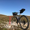
So at 09:08 on 2 August, I rolled nervously out of Old Bridge of Tilt car park with a plan to get round in about 40hrs - well under the ITT cut-off time of 56hrs but hopefully realistic for me.

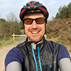
At the start
The first few hours passed quickly. I’d ridden the section to Glenmore a few weeks previously and decided I wanted to get to the cafe without too much stopping and faffing. I did have some brief faff when the GPX file on my borrowed GPS ran out 20km into the ride (down to my confusion over Garmin Routes and Tracks. I won’t make that mistake again). I decided to worry about it later and cover familiar ground quickly while I could.

No stopping for pics until I reached Glenmore
I got to Glenmore Cafe in just over five hours - about an hour quicker than the last time I rode it, but I was beginning to feel the ITT pressure… I had a really long way to go to stick to my plan and it was already mid-afternoon! I drank a lemonade and coffee, ate half a giant cheese sandwich and crammed the other half into my framebag. It was getting hot now and the big push over Bynack More was incoming.

An Lochan Uaine looking stunning through the trees
I stopped for a brief chat with a friendly US bikepacker called Scott who’d been touring the route in the other direction over four days and then started the climb. I rode as far as I could but didn’t want to explode in the heat and the drainage gaps are huge, so it wasn’t long before I was off the bike and pushing.

Pushing up Bynack More
I decided it was time for some music and as Dire Straits had been echoing around my head all morning I loaded them up on Spotify. After a couple of minutes the music stopped abruptly. I pulled the phone out of my pocket and pressed play. It was Norah Jones. I berated myself for not being able to operate a GPS or a smartphone. This happened a couple of times before I realised what was happening. A hundred miles away my wife was in the kitchen playing music with my Spotify account on a smart speaker and we were currently engaged in a Dire Straits-Norah Jones tug-o-war!
A quick phone call and plea that my need for music was currently greater and I was soon deep into Brothers In Arms.
The descent off Bynack More wasn’t easy for a non-technical rider like me, but at least it was downhill.
A brief stop at the Fords of Avon bothy, where the midges made themselves known for the first time and it was into Lairig an Laoigh. The rocky trail wasn’t very enjoyable. I knew it wasn’t going to be, but that didn’t ease the frustration.

Fords of Avon Refuge
Just as the path started to become rideable I spotted a couple of trail runners ahead of me moving fast. Catching them gave me a target to go for and a distraction from the annoyances of constantly hopping on and off the bike.
Thirty seconds later I hit a large stone that slid under the wheel and before I knew it the headphones were ripped out of my ears and I was in the steep heather on the right of the path. The middle finger on my left hand crunched painfully.
The finger quickly started to swell and became hot and tender. I thought it might be broken, but I didn’t really have many options so I got back on the bike (which seemed OK) and started riding again.
(Flash forward… An X-ray at Stirling Hospital a few days later confirmed it was broken).
I caught one of the trail runners just before Derry Lodge, but not the other one. Amazing to see how quick they could cover technical ground. The final section through the woods to the lodge was a fun and welcome respite from pushing and then it was an easy roll to Linn of Dee down estate track.
I reached the car park just before 8pm and really started to feel the pressure as I realised there was less than two hours of light left. My plan was to try to reach Feshiebridge before bivying, with half a thought that once I was at Feshiebridge I might be able to persuade my body to do a few road miles to Inverdruie and the attractions of the 24hr garage in Aviemore.
I turned west and straight into a headwind. The track here is mainly flat but it turns quite bumpy and it’s difficult to build up any momentum. I was starting to flag and was also completely unprepared for the frustrating path along Geldie Burn, which I joined just as the light started to fade. On the bike, off the bike, where’s the path? On the bike, off the bike, where’s the path?
This is the point when I really started to question my motivation for taking on a challenge like this. If I was simply doing it for a few extra Strava kudos points, then it was a seriously painful way of going about it.
I stopped to sort my lights, layer up and have something to eat. Just a 10-minute stop, but I instantly felt better. A useful lesson that sometimes a brief faff can help recharge power and motivation.
The next section was surreal. A scary footbridge over a waterfall in the dark. A path almost completely overgrown with broom and young pine. Scary drops to the left. Landslide debris and scrambling with a loaded bike on crumbling rock to the right. At one point I stepped across a gap and the ledge I placed my foot on crumbled and I watched the pieces fall out of my headtorch beam into the gorge below. My heart lurched. It got quite sweary.
I started spotting comfy bivy spots, but I really wanted to hit 150km before stopping. Then I would be over halfway and mentally would feel better about the following day. But it was clear at this point I was never going to reach Feshiebridge.
Just before midnight I rolled up to a building with a few people milling around outside. Of course! The gorgeous Ruigh Aiteachain bothy.
I heard someone with a Dutch accent shout: “Bikepackerrrr!”
“Is there room in the bothy?”
“Loads.”
Instant decision to stop. I looked at the GPS. 132km ridden. Not nearly as far as I’d hoped but it would have to do. At least I’d be away from the midges and would likely sleep better.
The group outside the bothy had missed the bridge on the walk up the glen and had just forded the Feshie in the dark. Hardcore.
One of them was swigging Grants out of the bottle and offered me a slug. I accepted gratefully. Best whisky I’ve ever tasted. I inflated my mat and fell asleep.
My alarm went off at 5am and I crept downstairs with all my kit to pack up outside so I didn’t disturb anyone.


The bothy
The morning was clear and cool, with mist hanging around in the hollows. I rode off at 6am feeling pretty good. Glen Feshie looked amazing and I stopped to take a few pictures of orange skies, purple heather and white mist.

Glen Feshie
Soon enough I was passing the airfield and on the road to Inverdruie. I let out a loud whoop as I finally closed the inner loop at 7am.
I was now in thick, chilly fog and put the lights on for the road bash up to Glencairn. Just before the track turn off the GPS flashed a low battery warning and I stopped to change the batteries.
I’d discovered late the previous day that the Cairngorms Loop was actually drawn into the basemap I was using, so was following that rather than a GPX file. But after putting in new batteries, I noticed that the basemap wasn’t loading. I reopened the case and realised the Micro SD card was missing.
Horror! I’d dropped it in the long wet grass next to the fence I’d propped the bike against. I spent the next few minutes getting soaked as I frantically searched the ground under the bike. I finally found it balanced on a blade of grass and I wiped it off and popped it back in the GPS.
The base map reappeared. Let’s go! I enjoyed the next section through Abernethy Forest. It was new ground for me and the day was still cool and young. I lost about 15 minutes after a nav error near Forest Lodge, but quickly rejoined the track and then climbed gradually to Carn a’ Chnuic and familiar ground.
The temperature was rising now and I knew the next section to Tomintoul was potentially a bit of a struggle with boggy ground, river crossings and a couple of climbs. But it was nothing on upper Glen Feshie and at 11:30 I was rolling into Tomintoul. At the post office I loaded up a bag with iced coffee, Sprite, ginger beer, water, cheese sandwiches, flapjack, batteries (the GPS had already burned through another set) and crisps.
I spread out in the shade on the green and had a good feed and a bit of repack, stashing away in my seatbag all the layers I’d gradually been peeling off over the last couple of hours. I ate half the food and packed away the rest. I’d decided not to stop in Braemar, so this would be the last big break of the day. I took almost an hour, but felt really good for it.

Eating and admin at Tomintoul
The next section was easy estate tracks and then the stretch of lovely singletrack by Loch Builg. At the loch I met a LEJOG rider who’d ridden up Glen Tilt the previous day on a rigid tourer equipped with panniers. Fair play. I had to walk sections of the Culardoch climb as my legs began to feel the miles, but again I was on familiar ground and I knew there was a quick descent coming up into Invercauld.

Top of the Culardoch climb
Then it was 5km of noisy, smelly road around to Braemar, which I rode straight through. A feed and coffee at the Bothy Cafe would have been nice but I was glad to be clear of the crowds and for the first time I started to become focused on the finish.
Geldie Burn was low and easy to cross. I still had reasonably dry feet at this stage and they stayed dry as I was able to hop across from boulder to boulder.
The turn south felt good and I put on some more tunes. The Killers’ Mr Brightside came on randomly and I actually felt quite emotional. It’s one of my wife’s favourite songs and I thought back to our bizarre technology-enabled connection as I pushed up Bynack More the day before. Already that seemed a long time ago. I thought about calling again but decided to push on.
The Glen Tilt singletrack was hard for me. As I said before, I’m a weak technical rider and by this stage body and mind were feeling tired.
When it was done with I sprawled out on the lovely patch of grass before the push to Fearlar Lodge and ate my last packet of crisps and drank the ginger beer.
The push was hard and steep, but I knew it was going to be. It seemed to take forever for the lodge to come into view - made all the worse because you can see the easy estate track just a few hundred metres away, unreachable on the other side of the gorge.
At the lodge there was a sign pointing cyclists around the grounds and I imagined how strange it would be to live in such an isolated spot, but have a regular stream of bikepackers passing by.
It was clouding over and there’d even been a couple of spots of rain. I layered up for the fast descent and readied myself for a glorious finish. It was 7:20pm and I wondered if I could be down in an hour. For some reason I thought it was easy downhill all the way to Blair Atholl.
What a major planning fail! I’d really not studied the map properly. In fact there are a couple of big climbs and a stretch of singletrack before the final descent to the station.
This was the other significant low point for me. I was totally unprepared for this final section. I was walking almost all the climbs. There was a lot of swearing and I reached that point where you start to think bad thoughts about the person who created the route. The midges had also started to gather and could easily keep up with my feeble walking pace on the hills. I felt inadequate and not equal to the challenge. It was pretty crappy.
But then I remembered why I was here. I was here because it was exactly what I wanted to be doing. There was no-one else to blame for feeling rubbish but me. It was going to be over soon enough and I didn’t want to ride into Blair Atholl in a bad mood.
I turned off the music and tried to reconnect with the landscape. I ate my last squashed chunk of Malt Loaf and concentrated on riding as much as possible. My mood began to change as I hit the lovely singletrack descent off Sron na h-Innearach, and then after one final river crossing, the start of the estate track which meant about 8km to go.
Lights on high - no need to conserve battery now - I began pedalling down the track as fast as I could. Several hundred miles away, my dad had been tracking my progress on the Life360 app for the last couple of days. I’d been out of range for 5-6 hours but he said later I popped up at this point and he watched me in real time hitting 50kmh+ on the beautifully smooth tarmac road down from Lude House.
And then, Blair Atholl. Passing by small groups of people either heading home from a night out, or moving to the next pub, looking curiously at the wild bikepacker sprinting down the street.
I reached the station at 10.20pm. Total elapsed time was 37hrs 12mins. I was very happy with that. I felt beat up, tired, hungry, thirsty and was aching everywhere. But I’ll probably be back for more. Thanks, Lee!