I believe there are another pair out there now having started over the weekend. I'm told #BigBear530 on Instagram will lead you to updates of their suffering ... however, I know nowt about Instagram so am just passing that on
I believe there are another pair out there now having started over the weekend. I'm told #BigBear530 on Instagram will lead you to updates of their suffering ... however, I know nowt about Instagram so am just passing that on
As of last night, anyone hoping for a first completion, still has a chance ... sounds like an ark might have been a good choice
I believe there are another pair out there now having started over the weekend. I'm told #BigBear530 on Instagram will lead you to updates of their suffering ... however, I know nowt about Instagram so am just passing that on
As of last night, anyone hoping for a first completion, still has a chance ... sounds like an arc might have been a good choice
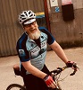
It was i (and a good mate of mine, Tom) that attempted (and failed) the bigbear route this week.
We set out to ride over and join the route at a sensible point to us via the Gospel Pass. All went well from Gloucester leaving at 8pm on friday in light rain, out and over the severn bridge, bivvy'd it just past chepstow on cycle route 42 and got a good few hours kip (best you can hope for on the first bivvy of the year for me - Tom had done a couple of weeks in Japan earlier this year but ive been mega busy racing xc this year to squeeze any in! anyway 32 miles done, 1500ft ele .
The first full day was a cracker, great weather, cracking food from a stall in Hay on Wye, then joined the bigbear route close to Veaullt, a little way clockwise round from the gpx start point. The route started well, loose gravel climbs, remoteness feel, lots of purple lined trails and lots of ferns, a lot of the trails were tricky to see the turns for overgrowth but progress was good. The final hour was really flooded and the route appeared to follow what resembled a 4x4 test track, with ample remains of 4x4s fenders as evidence, lots of climbing round unrideable puddles.Ended the day in a forest carpark, just past llanwrtyd wells. 88.5 miles 9885ft ele
The second full day was a mega cold start, 5degrees at first light, misty, but by the time we'd packed up the mist had lifted up high to reveal beautiful pockets of trees poking up through the fog as we were at around 1000ft. We rolled into Llandovery and smashed a veggie brekkie then the progress came to a halt. Tom somehow lost a breakpad and has unknowingly been using the caliper piston as a pad!!! cue completely siezed rear brake. Damage was too bad to repair with what we had so a lightweight ti tentpeg was sacrificed to tether it to toms rack... Front break only it was from now on. In order for us to ride the descent bits at a similar speed i also rode using front break only such that we kept a similar speed. Weather was good all day, stopped a few times for coffee making, and for some good food at the Towy bridge inn, the people next to us sat outside were also weirdly from gloucester. Bivvied at around 1550ft in the middle of nowhere by a stream (so we could make pasta and coffee!) 70 miles 9760ft ele hadnt seen any other food stops since 2.30pm at Towy bridge.
The third day started at 4am with the heaviest downpour ive ever camped in! Our tarp rigging skills were only just good enough to keep us dry! finally got up around 630am in light rain. By around 8am the rain was relentlessly heavy, Rode all morning, the stream crossings getting ever deeper, managed a rear puncture which stans wasnt having any of, so threw a tube in. Finally made it to Blwlch Nant yr Arian mountain bike park at lunch time - the first place wed seen in nearly 24hours and smashed double lunch each!!! a break from the rain was well received. It did ease up a bit but after an hour or so of setting off it was torrential again. The stream crossings were unmakeable at times, cue some attempted jumping skills, wading and general timewasting! The final 20 miles into machynlleth were singlehandedly the worst conditions i have ever ridden a bike in - thats sayign something given i race fatbikes year round in the uk!! up to the hubs for huge stretches!! The specific gravel that we were smothered in all day rubbed everything to the bone! Even the tongues of my shoes had made my feet bleed!! As for the saddle area - complete write off :( 'The chute' front break only was also insane!! cue a couple of low speed dismounts lol
We stayed at a pub in the town, lobbed all our gear in their boiler room with the intention to carry on the next morning. 43miles 5112ft ele
The weather report for the next day was good but both of us were red raw and although carrying on with now dry gear wouldve been manageable for another day, the report for the following two days was also very poor, we also werent sure how deep the river crossings would be that morning either as it has rained all night too. We decided to bail out here having enjoyed around half of the trail in the 2.5 days we had spent on the actual trail.
This route is mega mega amazing, but really needs either a 5 day weather window, or a tougher arse than us to cope with welsh 40 grit abuse!!
Some of it would be unrideable even in good weather, one really tough climb on the last day springs to mind, when i do get round to having another stab at it again i will probably carry more food and water supplies than we did. 5 days is probably achievable, we werent physically exhausted when we got the train back to gloucester on Tuesday, i rode the 13 miles back home (stood up), then raced xc (also stood up for most of the race) on wednesday eve! I dont think 3 days of rain wouldve left me in a walking state though!!
bike wise, i used a carbon 29er race bike with a lauf fork upfront, to mix it up tom chose his trusty 26" inbred hardtail. both were more than capable of the terrain.
Interesting write up. Sounds like you needed to be flexible regarding the route.
I hadn't picked up on river crossings. Did you carry maps or just 'explore' round obstacles?
I find zooming out on the gps a great help when looking for alternative routes.
Just thinking out loud:
Will Stuart allow the route to be done in sections ie could you re start at Machynlleth and just claim elapsed time on route?
Will a completion count after 22 September when summer ends?
If we can manage a proper spell of dry wintery weather, it should be great. Undergrowth or maybe that should be overgrowth in summer slows things up a little and may account for the occasional 'WTF am I?' moment ... no such troubles in winter.
I think that a lot, if not all, of the ITTs particularly south of the border begin to get overgrown through summer. The YD300 at the start of July had a bit of jungle bashing around Wharfe and Feizor for example - do I lean left to avoid the nettles or right to avoid the brambles?
Better weight than wisdom, a traveller cannot carry
whitestone wrote:I think that a lot, if not all, of the ITTs particularly south of the border begin to get overgrown through summer. The YD300 at the start of July had a bit of jungle bashing around Wharfe and Feizor for example - do I lean left to avoid the nettles or right to avoid the brambles?
Round here it's plough through both - No room to avoid either side.
On the plus side, you are geting sensations for which some folk pay good money in darkened places, all for nowt in the fresh air.
Two sections of the bearbones 200 were the same as the big bear. I remembered them well as we went past one spot we bivid at.
Anyway the trails were actually a bit drier in my opinion at the weekend to what they were like in August when we bailed out! A 4-5 day dryish weather window and I reckon it’s doable this year....
That would be particularly impressive given how wet ground conditions have been recently
We go out into the hills to lose ourselves, not to get lost. You are only lost if you need to be somewhere else and if you really need to be somewhere else then you're probably in the wrong place to begin with.